 Friday, July 26, 2024
  Friday, July 26, 2024

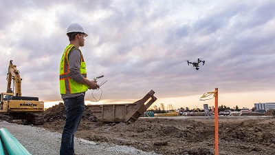
The use of drones commercially is skyrocketing around the globe with brand new ideas popping up in different countries. Companies like Matternet want to make peer-to-peer drone delivery common and Amazon wants to send your packages autonomously to your house via drones; but in the field of construction, drones are taking over by giving architects and builders crucial real-time data and 3D aerial maps from construction sites that was once expensive and difficult to obtain.
The main purpose of using a drone on a construction site is for surveying purposes as well as record keeping and portfolio building. These aircraft give you a distinct vantage point from the sky that no other piece of equipment (short of a helicopter) can do. On top of these benefits, using a drone is very cost effective and easy to use due to its autonomous flight features.
Click here to sign-up and receive the Weekly Round Up in your inbox every Saturday
Aerial pictures and videos give professionals in the field of construction a brand new way to survey an area of land or a current project. It can alert workers of problems that are unseen from the ground and provides an excellent look at the progress of the work-in-progress.
One of the most popular forms of drone surveying is map building which can be done effortlessly with an application called DroneDeploy. Using their mobile app, pilots can plan a flight for their drone to follow, where it will take countless pictures along the assigned route. While these images might be of no importance by themselves, the online DroneDeploy application stitches all of the images together to make one high-resolution map.
The benefits of having this map are significant, giving project managers on the job site an up-to-date map of the surrounding area. Within the DroneDeploy application, you can take measurements on top of the map like distance and area to help with planning. They even include an option to view a 3D model from the photos that were taken.
According to analysts collected by DroneDeploy, usage of UAV’s has jumped 239% in construction. This is a major increase compared to mining at 198% and agriculture at 172%.
Keep reading this article on DroneDJ.com
