 Friday, September 27, 2024
  Friday, September 27, 2024
High in the sky, far above undulating hills flooded with bright yellow gorse bushes, a small black dot zips back and forth. It flies first one way, then back the other in a matrix formation, taking dozens of pictures of the ground below.
“A drone takes a twentieth of the time and a quarter of the cost than using humans would [to survey land],” explains Chris Fleming, whose Edinburgh-based company Cyberhawk can take images of more than 200 hectares of land in one day using drones.
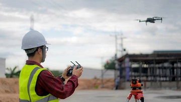
Cyberhawk says it has seen an uptick in the use of such drones in the construction industry. Their low cost and ease of handling has made work more efficient for the engineers, architects and builders across the UK.
“What would have happened traditionally is the surveyor would have gone to the remote location with their GPS equipment and they would walk 20 metres, stop, put the staff in the ground, press a button to measure the height and location of the land, and go up and down the landscape in a grid pattern,” says Fleming.
“Now, rather than them spending two weeks traipsing all over that land, we can fly a drone over instead and create a photorealistic model.”
Advances such as these are likely to have major implications for the cost of building work. As it stands, around 80 per cent of construction projects run over schedule, and 20 per cent are over budget.
According to figures from PricewaterhouseCoopers, drones could save the UK construction industry £3.5 billion (NZ$6.84 billion) by 2030, making surveying 400 times faster and allowing data from the sites to be shared with stakeholders with ease.
A large part of the potential savings boil down to drones’ capacity to map large areas of land, or buildings themselves. Fairhurst Estates, for example, a chartered surveying company which started using drones more than four years ago, says they allowed it to scale buildings without actually having to get on top of them.